
NASA has shared a wondrous image of Perseverance captured by the Mars Reconnaissance Orbiter, showing the rover exploring the Red Planet’s ‘South Seitah’ region all on its own and collecting valuable data that will eventually pave the way for manned missions to the planet. The South Seitah is actually the farthest point of location sampling for the mission so far, and based on imaging data available, it predominantly consists of sedimentary rocks. However, images captured by the Ingenuity Mars Helicopter back in August also showed dunes, rocky outcrops, and boulders on an otherwise dry and arid landscape.
The word South Seitah is said to have been derived from the Navajo language and it means ‘amidst the sand.’ As part of its mission, the Perseverance rover will explore the south and west regions of the Octavia E. Butler Landing Site to collect samples from what NASA says are potentially the oldest accessible geological units in the Jezero crater. Once the southern phase of exploration — which includes studying the Crater Floor Fractured Rough — is over, the rover will return to the landing site and begin the next phase of the mission by moving in the west direction.
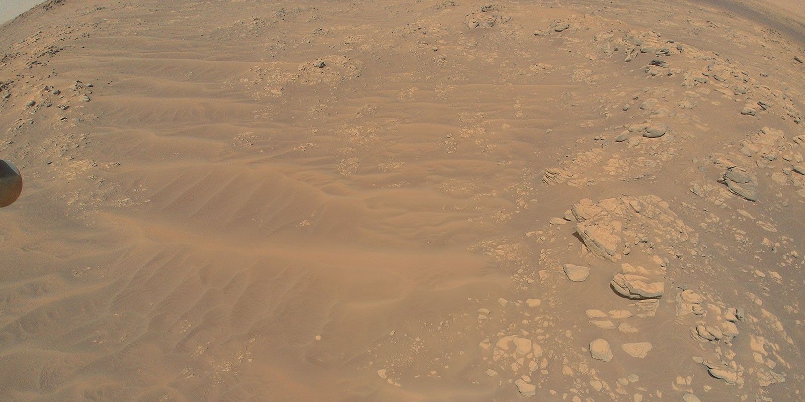
The latest image of the Perseverance rover shows its current position in the South Seitah region. Clicked by the High-Resolution Imaging Science Experiment (HiRISE) camera on the Mars Reconnaissance Orbiter, the remarkable image depicts the Perseverance rover as a tiny white speck against the backdrop of Martian soil with a lot of ridges and other rocky structures. The rover recently captured a beautiful image of the aforementioned dunes, which show a lot of variety in shape, size, and composition based on their location.
In the words of NASA, the Perseverance rover has been designed to study the climate and geology of Mars, especially the stones that can reveal the secrets about how the Martian surface evolved over time. A recent study revealed that despite its current dry looks, early Mars actually witnessed violent floods that created the deep canyons and river valleys on the planet. More importantly, the Perseverance rover will be looking for rock samples that may have originated in watery conditions and might very well preserve evidence of organic molecules that form the building blocks of life.
The end goal is to test technologies that leverage the natural resources of Mars for potential use as fuel and towards supporting life. The data sent by the rover will help scientists better assess the environmental conditions of the planet in preparation for the Artemis Project that aims to put a man on Martian soil in the 2030s. Less than a month ago, the rover shared images of rocks that appear to be volcanic in origin and might be containing trace amounts of salts that possibly hold bubbles of water from early Martian conditions. Such rock samples are said to be ideal for radiometric analysis. And once their age is calculated with a certain degree of accuracy, scientists might be able to learn a lot more about the planet’s evolutionary history and clues to habitable conditions in the past.
Source: NASA
from ScreenRant - Feed https://ift.tt/2YhvHN7
via IFTTT
No comments:
Post a Comment